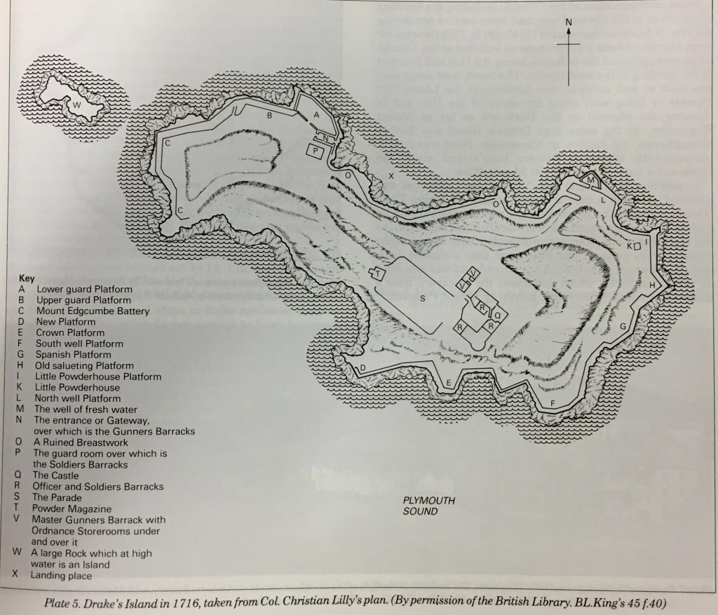
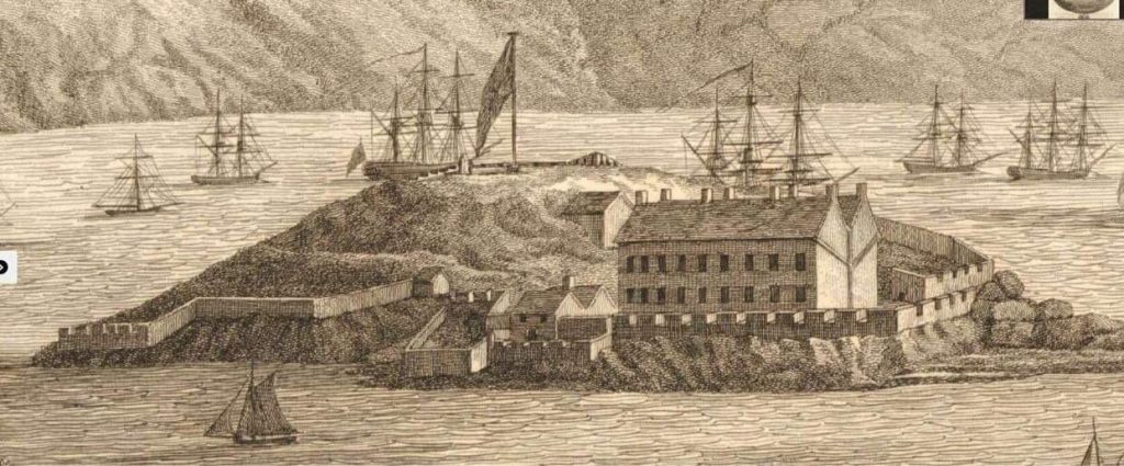
The Box Archives are a rich source of research for whatever you are looking into. On a recent visit I came across some of the technical plan and section views of the buildings on the Island done by Colonel Christian Lilly of the Royal Engineers for his 1716 survey. His wider remit was to survey and make recommendations for what may be needed in the way of repairs and additional works at various places along the South Coast in his post as the Kings Third Engineer. On the Island he surveyed four buildings that he labelled as the Castle and Master Gunners Barrack together with the Powder Magazine at the top of the Island. He also surveyed a Gateway and Gunners Barrack at the entrance to the Island, the same place as today together with a Guardroom and additional soldier barrack near the same place just behind it.
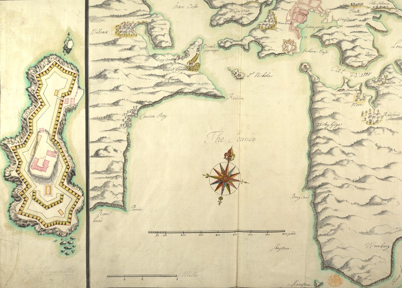
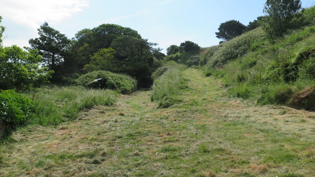
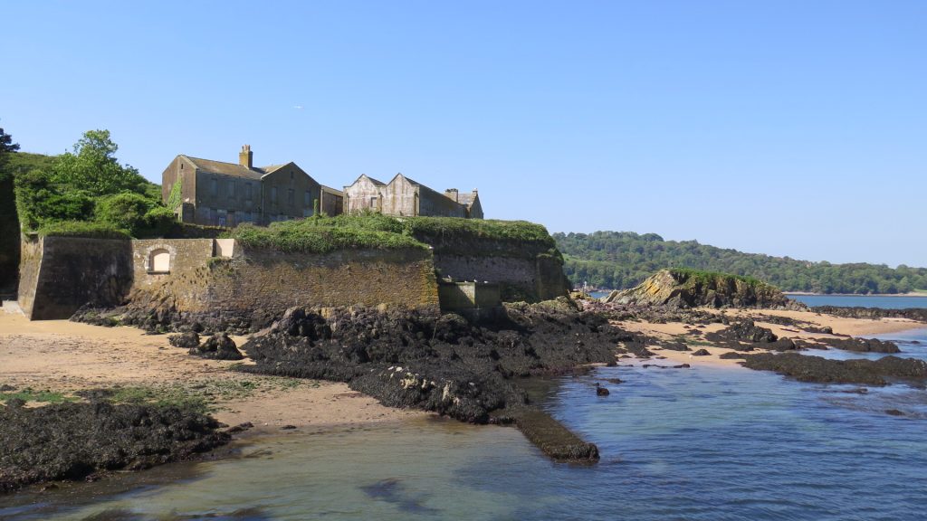
The Map above shows the buildings surveyed by Colonel Lilly in pink on the right hand side plan. The buildings at the highest point and next to each other are the Castle and Master Gunners Barrack. The Powder Magazine is on the edge of the rising ground so roughly where the ramp to the top of the Island is today. The Guardroom and additional soldiers Barrack are roughly where the Governors House is today and the Gunners Barrack and Gateway are roughly where the current vaulted entrance is today. The maps and charts below corroborate that the buildings stretched back to at least 1591 so were the original Tudor buildings albeit with some modifications over the years.
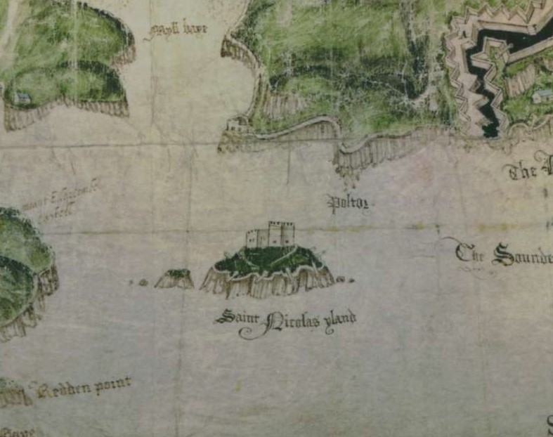
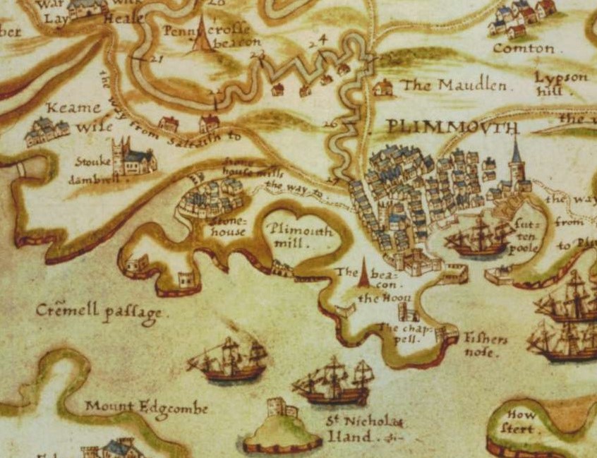
We also know from parliamentary and financial records that no major works were carried out after Frederico Jenebelli’s upgrades and repairs to the 1550 fortifications in 1600. The following two maps from 1591 and 1598 also show the buildings that Colonel Lilly surveyed in place.
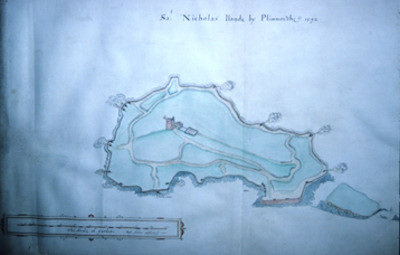
Below is Colonel Lily’s plan view of the Island. It was copied from the 1717 original.
The following plan and section views are held in the Box at Plymouth in digitised form and not available for direct copy. I was allowed to make my own notes and draw them myself which I have tried to reproduce below. Hopefully they will at least give an idea of what the original buildings would have looked like.
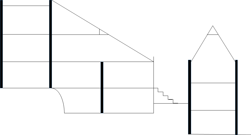
The above reproductions are of the section views of the Castle and Master Gunners Barrack. Each floor was approximately 10ft high by 15ft wide.
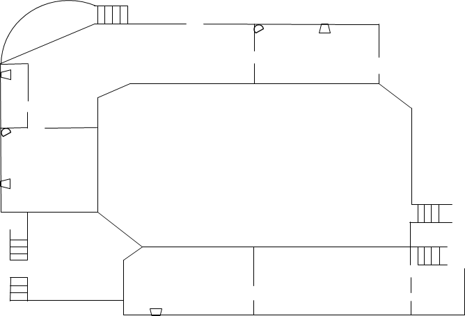
The Castle was three stories high and the top capped with lead. The drawing above is of the ground floor. The D shape denotes a spiral staircase and the other shape on the walls a 4 sided trapezium represents windows. The large central area is a Courtyard, the 4 rooms at the top of the drawing are the Sutlers House, a civilian who ran the stores on the Island, and the rooms at the bottom from left to right are an entranceway and the soldiers barrack.
The first storey had more Sutlers rooms at the top left (the rounded construction). The Officers Quarters were to the right of the Sutlers rooms and more soldiers Barracks down the left of the building as shown in the plan and the two rooms on the bottom of the plan facing the outside. The Sergeants Barrack ran along the soldiers barrack at the bottom facing the inner courtyard. Finally there was a kindling and later coal store next to the Sergeants Barrack. There was no plan available of the Upper or second storey or of the basements. My guess is they would just be store rooms but it is just a guess.
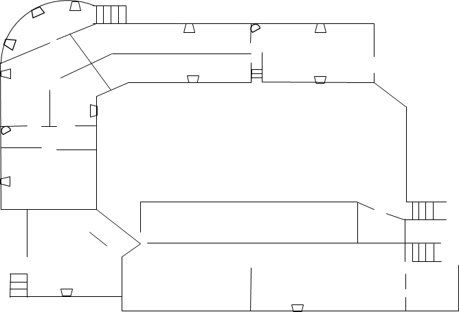
This is the plan of the Master Gunners Barrack. The ground floor is left and the first floor right. The overall dimension is approximately 15ft wide by 30ft long with each room on the first storey 15ft x 10ft. The military store comprised the whole ground floor with accommodation and a separate ordnance store above it.
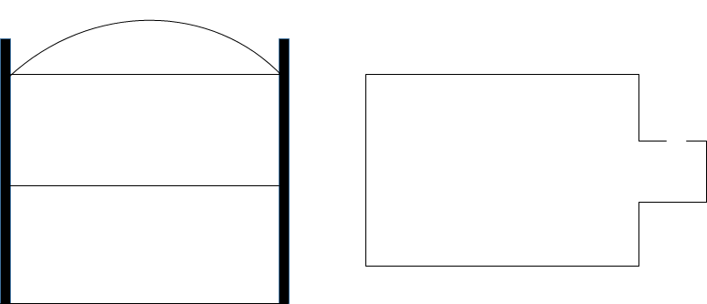
The section (left) and plan (right) above is of the Powder Magazine. It was a two story building with internal stairs (not shown) approximate area was 10ft x 10ft with a total height of about 20ft.
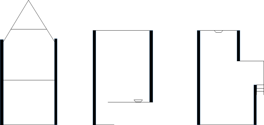
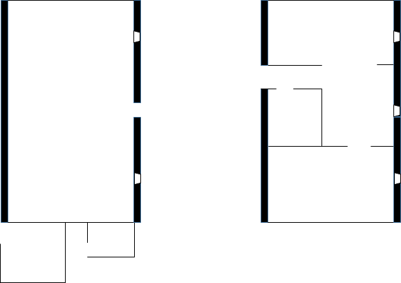
The section (left) and plan (centre and right) views of the Guard House and a second Soldiers Barrack. The ground floor was the guardhouse and first floor the Barrack. The rooms were approximately 10ft by 10ft with a height of 10ft per room.
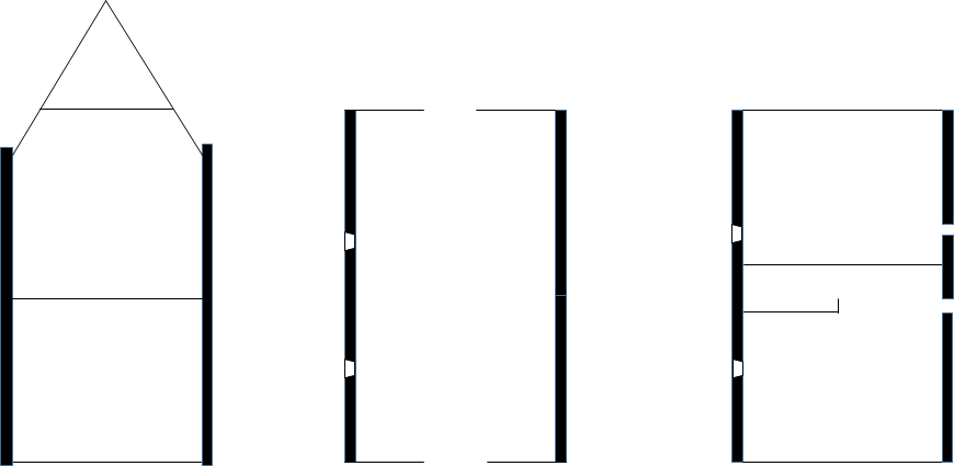
The section and plan views of the Gateway and Gunners Barrack. The ground floor would have been open at both ends as a kind of tunnel with the Gunners Barrack above it.
The buildings would also have provided the Prison Cells during the Islands time as a State Prison from 1660 to 1685. There were never many prisoners only a maximum of 12 and only 6 were held at any one time. Most were released on payment of bond after only a few months in any case. The cells were described in one case as without light light, dank and underground and another report describes rusting bars on the doors. This would fit in with the basement stores and some of the barrack rooms were windowless as well. There are also no reports of any prison block being built on the Island for the prisoners so it does seem most likely that some of the rooms in the buildings surveyed by Colonel Lilly did double up prison cells.
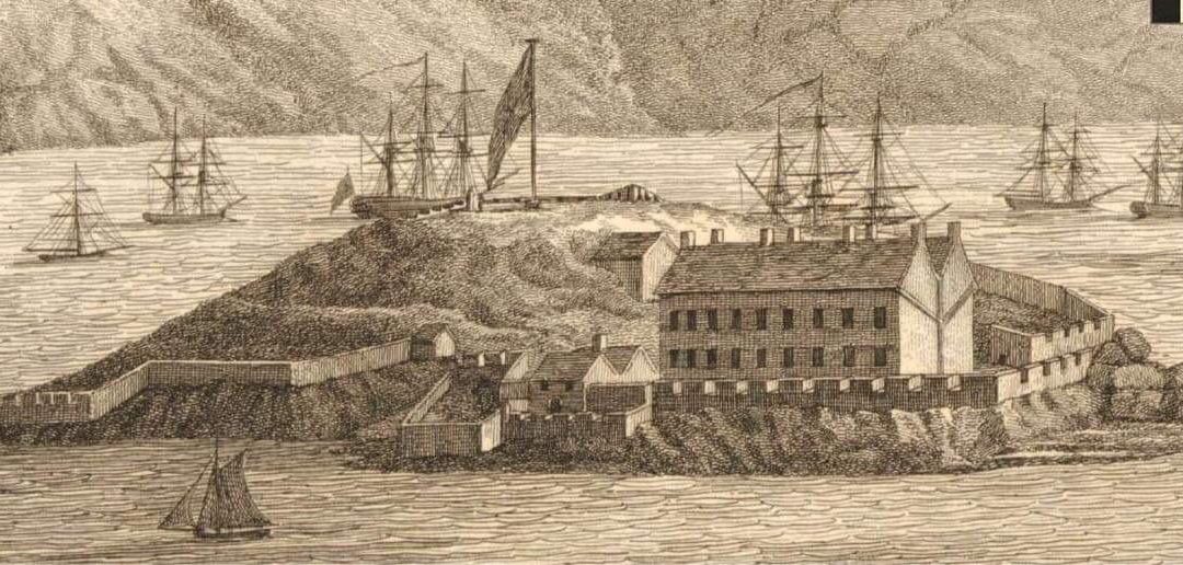
The Gateway was demolished by 1830 at the latest. The Guardroom was most likely incorporated into the Governors House by that stage as that area of the Island was developed as a new Master Gunners Accommodation and then finally the Governors House by that date. The next Blog I’ll put up and describe some photo’s I’ve found of the Garrison at the start of WWI in 1914.