I thought it may be of interest to have a look at some of the images, charts, paintings photographs and the like to see how the Island has changed over the centuries. The vast majority of the images are looking at it from the Devon or Cornish mainland so I’ll stick to those and some later overflights.
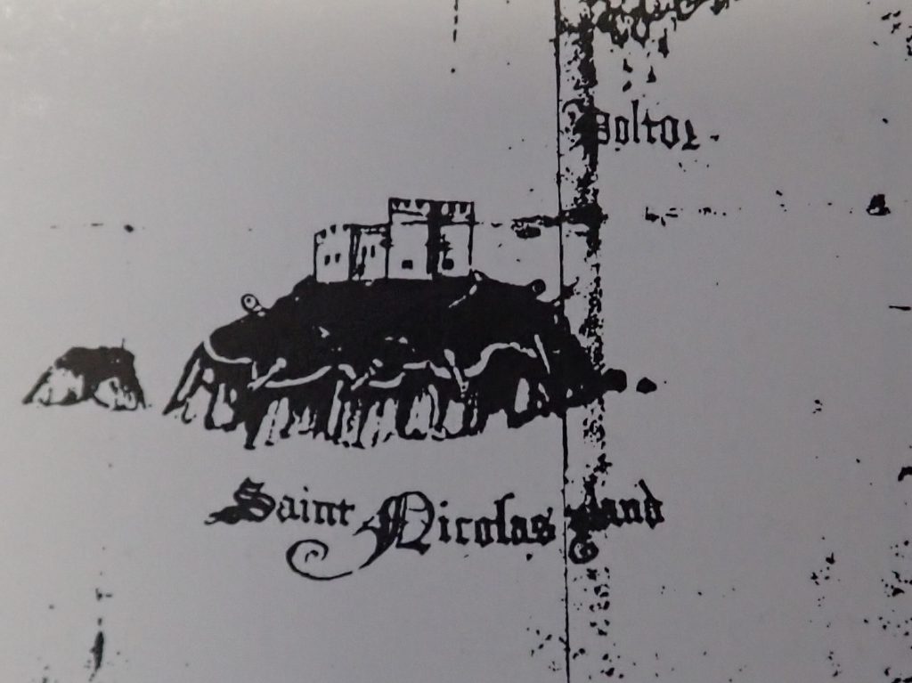
One of the earliest images is from around 1540 of the Island with just St Michael’s Chapel at the summit. It is not to scale,
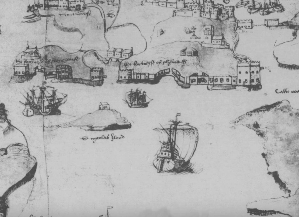
The Island would have been in the hands of the Duchy of Cornwall. The Plympton Priory which held the lands from the Duchy was dissolved in 1537 and it’s lands returned to the Crown or Duchy whoever the Priory was holding the lands from. There a couple of interesting points. The Island is shown as devoid of trees and vegetation and as an Island formed from Devonian Limestone and fossilised volcanic lava only grasses that could survive on the coast would grow there. The vast majority of the trees and vegetation seen on the Island today was bought across in the 1960’s and 70’s although some earth was bought across for the Tudor and Victorian fortifications as defensive earthworks it wasn’t to support trees and vegetation. The Island is also more rounded than today. Later fortifications meant that parts of the Island were either built up or dug out to make pathways or foundations for the buildings. Coastal erosion also had an effect over the centuries especially at the back of the Island exposed to the English Channel which didn’t have the protection of the breakwater until 1841. Both these effects have changed the coastline and shape of the Island somewhat.
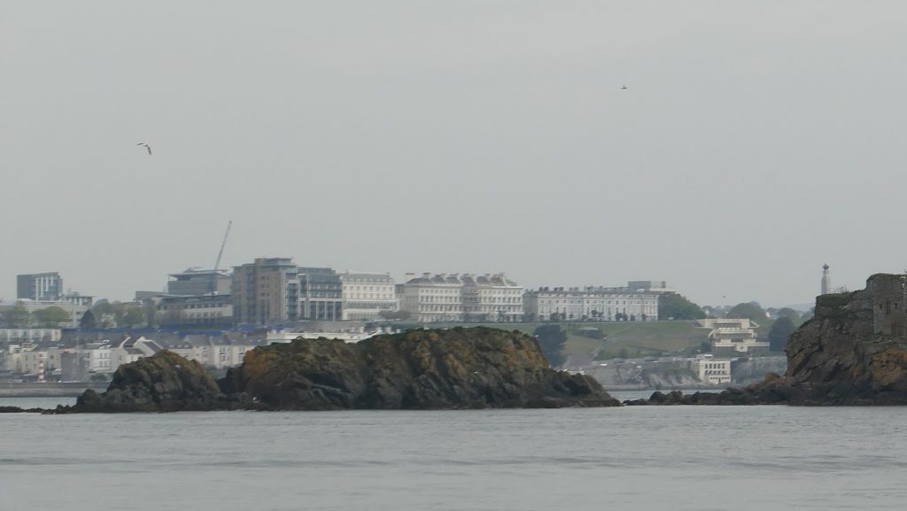
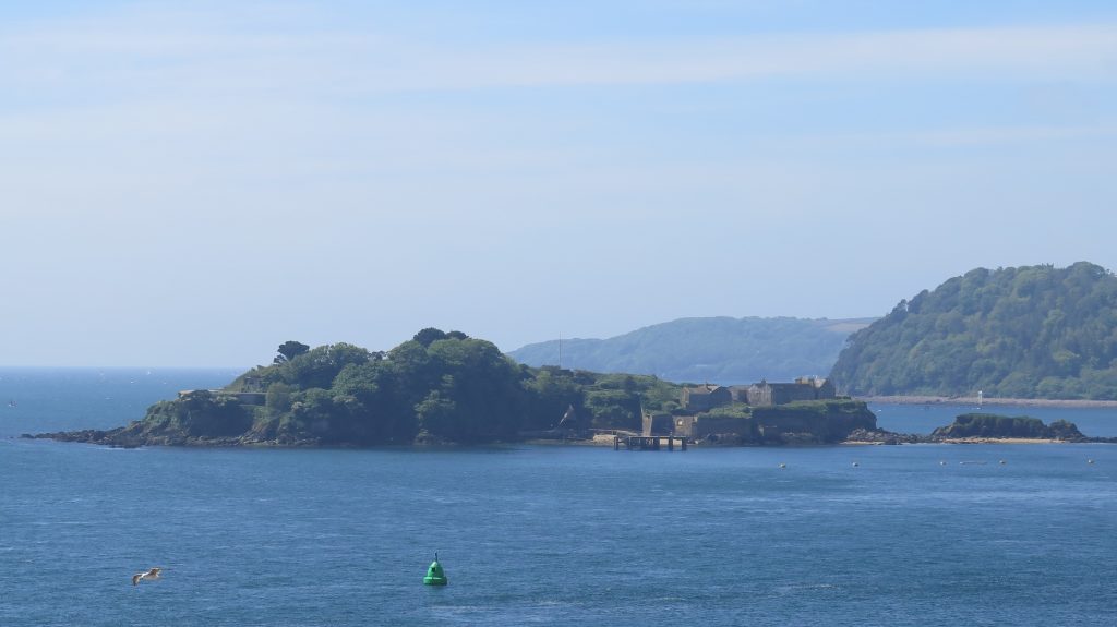
This recent photo of Little Drake’s Island next to the larger Island shows how the Island would have looked over the years, together with its buildings and fortifications until the trees and other vegetation were transplanted.
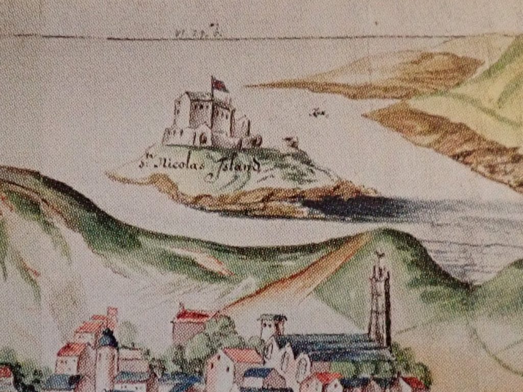
St Michael’s Chapel was demolished by order of King Edward VI to make way for the first Tudor fortifications, These were started in 1549 but because of financial limitations and wrangling were not fully complete until 1601 under the direction of Federico Genebelli, Queen Elizabeth I Engineer.
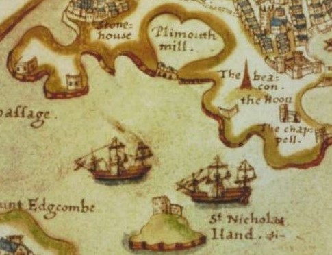
The Spry Chart shows the main Tudor Buildings at the top of the Island that replace St Michael’s Chapel. The main barrack is closest to us with the Master Gunner Barrack and store behind it. The Tudor Magazine, Gunner’s Barrack and Guardhouse are not shown although the outer defensive wall is depicted. Federico Genelbelli reported this as being 150 rods of wall. A rod was a surveyors tool of the time measuring around 5.5 metres which would give around 825 metres of wall. As the Island measures around 400 metres by 100 metres (at its widest) this would be about right for a defensive wall around the Island. Earth would have been bought across and compacted as added strength to the outer wall which is confirmed in Genebelli’s report of the time.
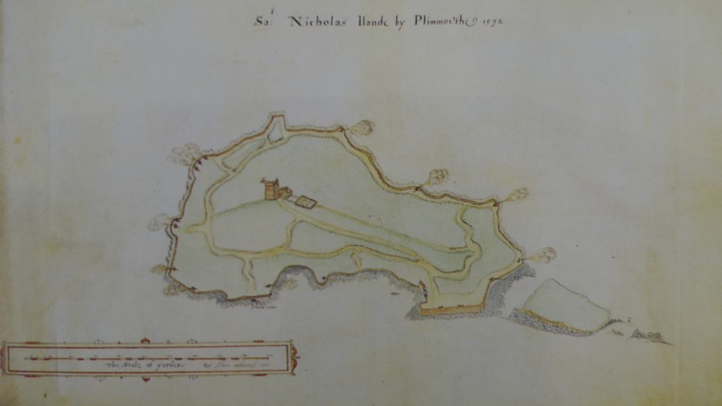
The Robert Adams chart of 1592 chart, part of a more detailed report to the Privy Council, shows the Gunpowder Magazine below the two buildings on top of the Island and more detail on the paths that were cut out of the Island and led to various Gun platforms around the Island. The Guns would be able to fire on enemy ships using the South West Passage between the Island and Cornwall and what is now known as Drake’s Passage between the Island and Plymouth. The Chart also shows the Island devoid of trees and vegetation.
Bernard de Gomme was a Dutch Engineer who received a commission from Charles II to build the Citadel. His chart of 1665, drawn from the Hoe, shows no change to the Island from the Tudor fortifications, the same buildings are in place. The guns would have been of the same design and made of wrought iron firing balls or shot at wooden warships. At this time the Island would have been used as a State Prison for a few high profile prisoners. In 1665 there were only two prisoners, Colonel Robert Lilburn who died that year and Abraham Cheare a non conformist Baptist minister. The following year saw another 8 non conformist minister held on the Island but only for a few months before they were released on bond. The prisoners were kept in the existing buildings, no new buildings are shown on the chart and there is no written or financial record of a purpose built prison being constructed.
This slightly later watercolour painted from a different position. Mount Edgecumbe, in 1680 when the Island was still a prison again shows no new buildings. The different perspective shows the Tudor Gunpowder Magazine in the middle of the Island and Guardroom to the right. The only prisoner at this stage was Major General John Lambert who would die on the Island from natural causes in 1685 when the Island ceased to be come a prison.
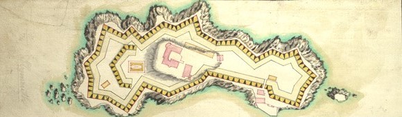
This 1716 survey by Colonel Christian Lily, the Kings Third Engineer, shows the Tudor buildings in pink with proposed changes to the defences in yellow.
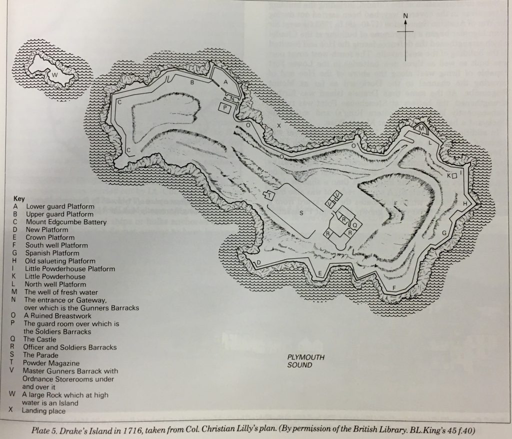
This Colonel Lily survey is just of the actual buildings on the Island but shows some of the relief on the Island indicating high ground and pathways cut into the Island. It’s worth pointing out that the well of fresh water (M in the key) refers to what we would know as a holding tank filled with fresh water rather than a source of fresh water on the Island. Also fresh is not what we would understand as treated water fit for drinking today. In Tudor times and later ale was drunk by the lower classes and wine by the upper classes and the Garrison was on beer and rum ration up until around 1900.
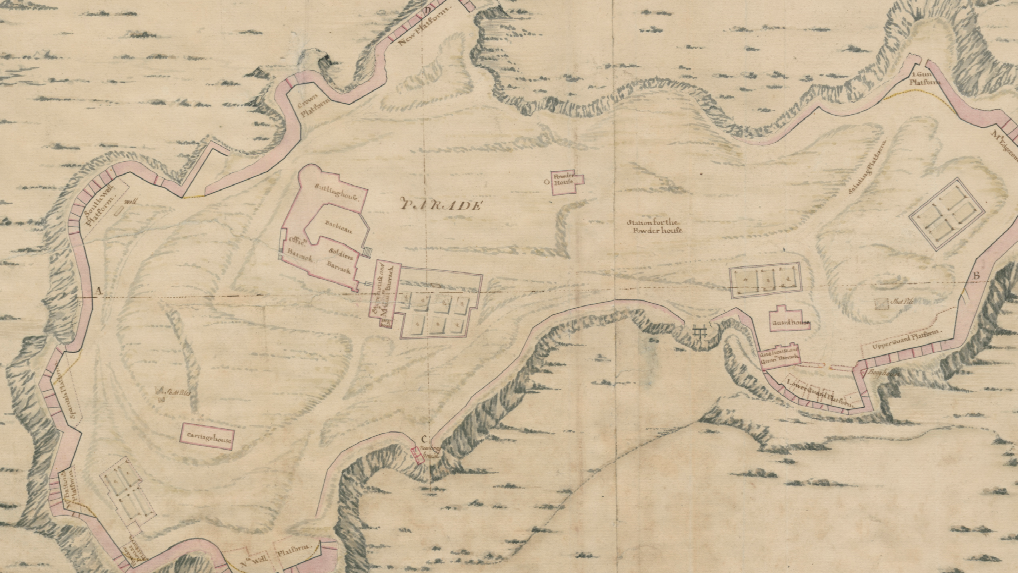
The chart was drawn in 1725 and also shows the relief and how paths were cut into the Island to link the Barracks, stores and gun platforms. A few additional buildings are shown which are Gunpowder magazines. Great Britain was involved in numerous wars around this time so positioning additional powder stores closer to the gun platforms may well have been part of the defence plans at the time.
This 1755 drawing shows the first part of the Soldiers Barrack (on the left) built but the main Tudor Barrack still standing at the top of the Island with the magazine just below it. The Island is still devoid of any vegetation or trees.
This painting, done in 1766 shows little change with the main Tudor Barrack, the newer Barrack (on the right and a couple of gunpowder magazines.
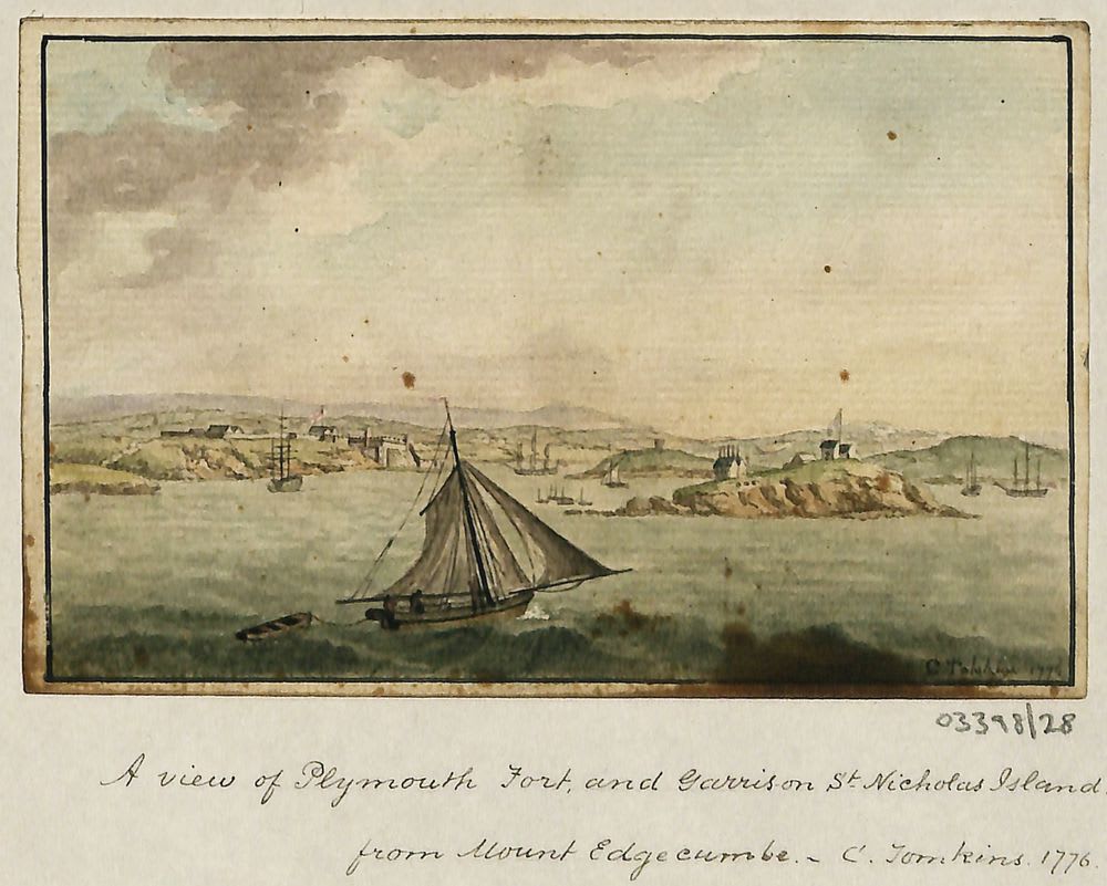
Another painting done in 1776 shows no change either to the buildings or to the flora on the Island.
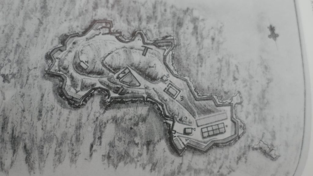
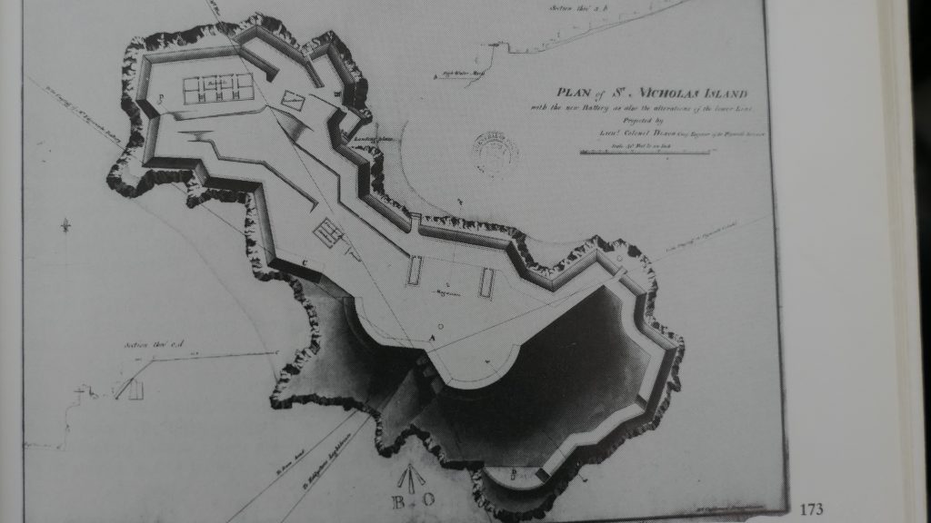
The two drawings were done not long after each other with the bottom drawing a survey done by Lt Col Matthew Dixon RE in 1780. I’ve shown both as the top drawing shows the relief of the Island and most of the buildings are similar. All the Tudor fortifications at the top of the Island have now been demolished. The Tudor Gunpowder magazine is the only building from that era still left although parts of the Tudor outer wall and the Artillery Tower which was now acting as a water tank are still in place.
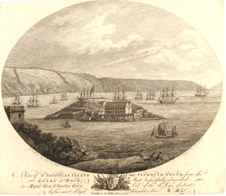
This sketch was done in 1781 and shows the Tudor Buildings replaced by a Battery of guns at the top of the Island. These were to provide extra protection to the expanding Devonport dockyard. The Tudor Gunpowder Magazine is still in place to the left of the roof of the main barrack.
Over the next 80 years or so the new Barracks area at the west of the Island was gradually developed as a second Barrack now referred to as the Governors House and the Ablution Block were built. These are till standing but a few other buildings, the 10 Pin Bowling Alley known as Skittle Alley have been demolished.
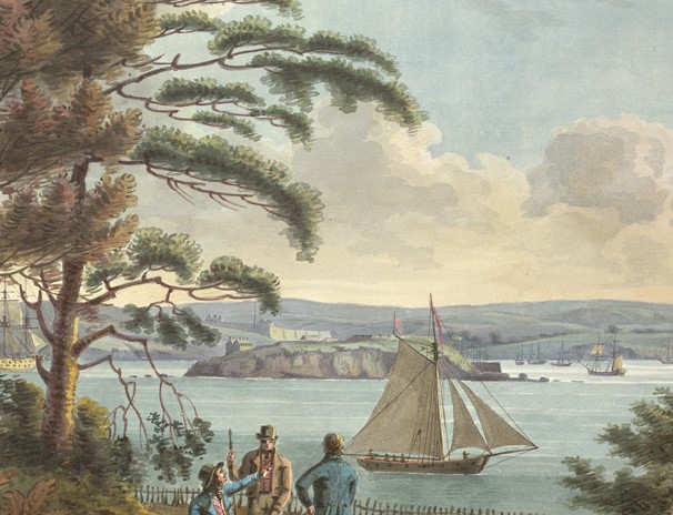
This painting done around 1800 shows little change to the Island fortifications. The Guns were still the same design from the early Tudor Guns using heated cannon balls and shot to defeat wooden warships should they attempt to attack Devonport or Plymouth. The effective range of the guns was still around 600 metres meaning the arcs of fire couldn’t be interlinked with other forts although between them they could cover most of the passages entering the Sound. The breakwater would not start to be built for another 14 years ad there is still no vegetation on the Island. The only earth being that bought across for defensive earthworks.
This drawing from around 1830 shows the guns of the Upper Battery at the top of the Island and the start of the second barrack block (the Governors House) to the west (right on the image). Both Barrack Blocks were built in two stages, The ablution block hasn’t yet been started but the old Gunners Barrack above the entrance arch on the top of the Island is still in place.
Queen Victoria drew this image from her yacht moored off Mount Edgecumbe in 1846. The Tudor gunpowder magazine is still in place below the Upper Battery and the Ablution Block was finished but the buildings to the west aren’t clear.
This 1850 painting by John Bennet shows both Barrack Blocks and the Ablution Block as complete. The interesting thing comparing the various images is how they view the Island. Some are more to scale than others and the Island relief is interpreted differently but they are all valuable in seeing the development over the years especially when we look at what we know of the Island from written records and reports.
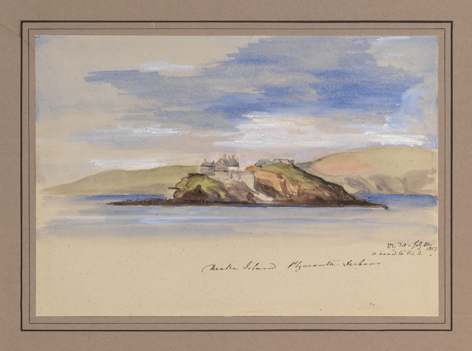
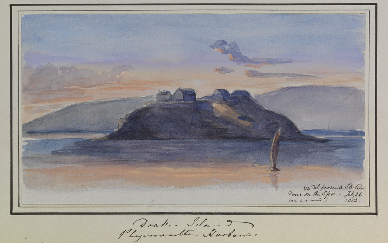
These two paintings were done a week apart, July 19 1852 and July 26 by Queen Victoria again from her yacht when visiting Plymouth.
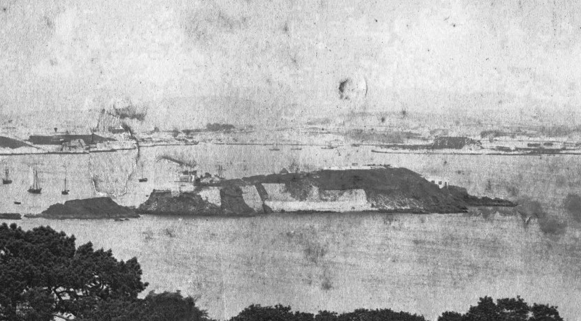
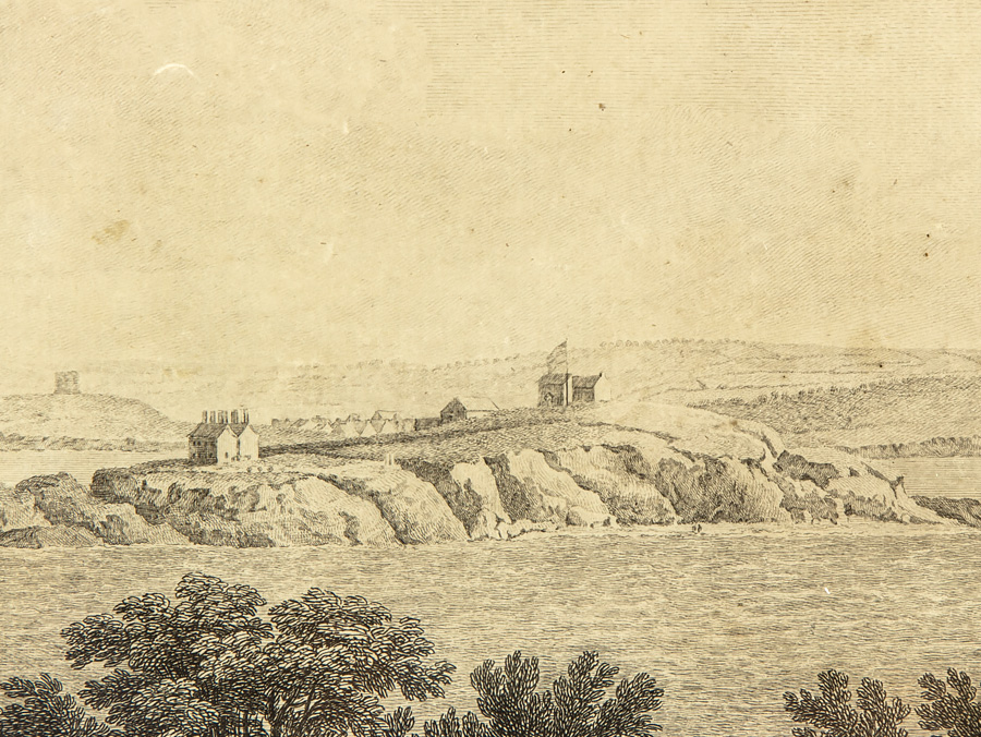
This is one of the earliest photo we have of the Island taken in 1865 from just by Mount Edgecumbe Folly. This was during the Palmerston Fort Building programme. For the Island this was the construction of the Casemates on the foreshore facing towards Mount Batten, Jennycliffe and the Breakwater, a new Battery of guns on the top of the Island and the underground magazines and ammunition tunnels. The guns were rifle muzzle loaded and a new design meant the guns could punch through 15 inches of steel at a kilometre and defeat the new Iron clad warships. In the photo the old Upper Battery of Guns are still in place, the new guns wouldn’t arrive until 1872. The casemates. although not yet complete, are visible to the right of the Island. The Casemates wouldn’t be complete until the installation of the guns and blast shields in 1872. The Breakwater would have been complete by now. The back of the Island shows the Sea Wall, which was started in 1854 complete.
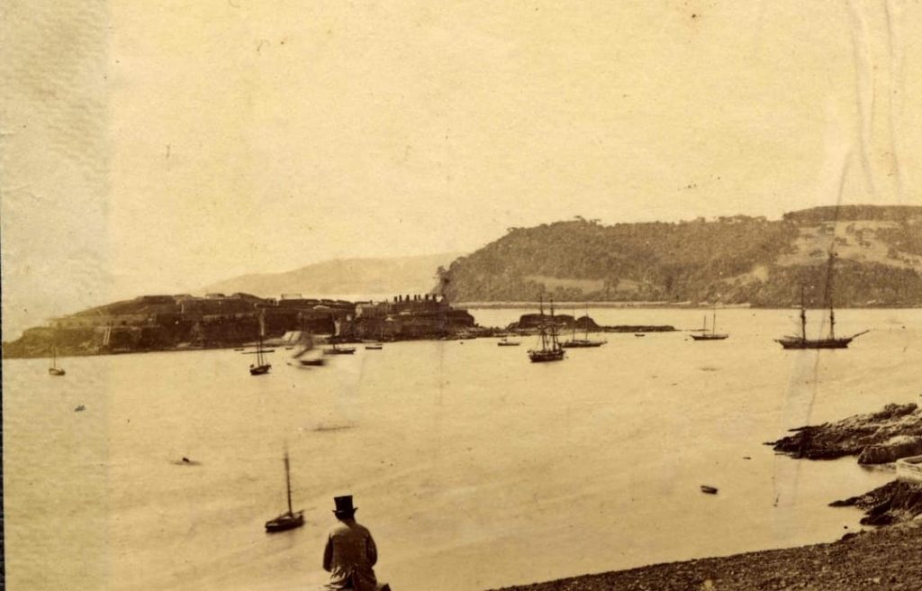
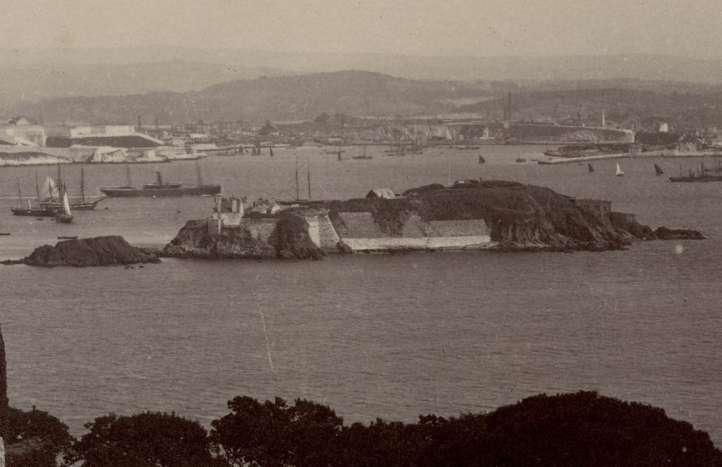
This 1877 photo would have been taken a few years after the completion of the Palmerston Fortifications on the Island which were constructed from 1861 to 1872. The Island Guns now had overlapping arcs of fire with the other forts and Batteries defending the Sound including Forts Bovisand and Picklecombe. The slip for the Island boats is visible on the foreshore and to the left leading down from the casemates is the Gun ramp and gun wharf specifically designed to get the new guns on the Island.
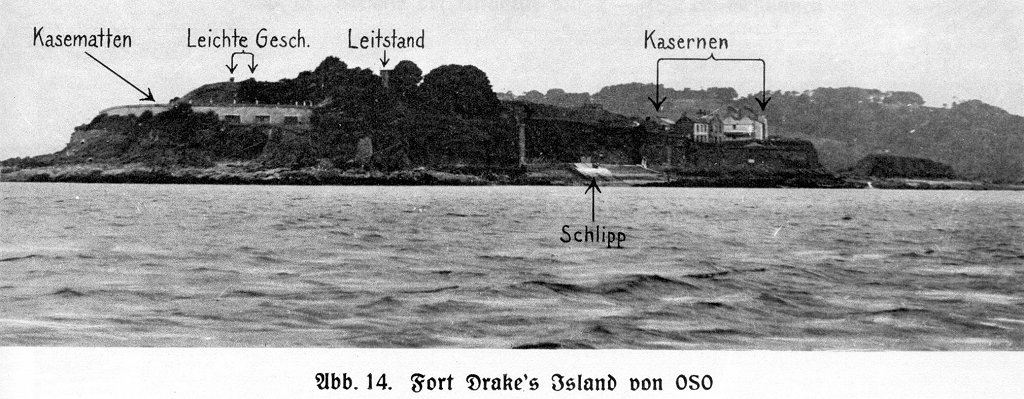
This is a close up of the new Upper Battery taken around 1890. The 11 and 12 inch 25 ton Guns, five in total, are in place between defensive earthworks beneath which are forward stores to support the Guns. The casemates, which housed slightly smaller 9 inch 12 ton guns are complete and just below the casemates on the high water mark is where the searchlights would be installed in 1895.
Again from around 1890 – the Breech Loading Batteries which were constructed from 1898 are not in place – the building in the centre of the Island is the old Tudor Gunpowder magazine which wouldn’t be taken down until the end of the century.
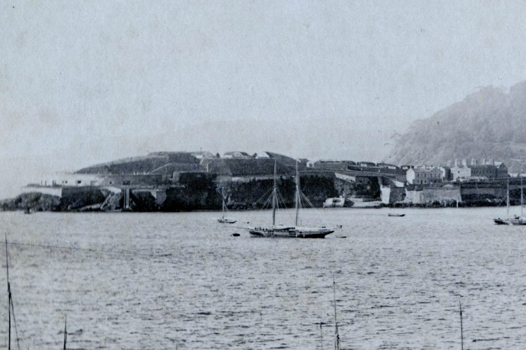
The front of the Island again from before 1898 and most likely around 1890. The slip for the Island boats is on the beach. The Gun ramp and wharf below the casemates is in place that was designed and constructed by Lt Hare RE to get the RML Guns onto the Island. The buildings are all complete to the right including just behind the outer wall Skittle Alley the Garrison 10 pin bowling alley. Still at this point there was no vegetation or trees on the Island.
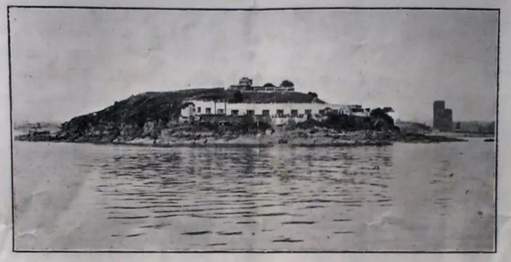
Unfortunately although we do have the Royal Engineer Surveys there are limited photos of the Island showing how it changed until after the military left. The Breech Loading Batteries were constructed from 1898nto 1901 during which time the Tudor gunpowder magazine was collapsed. A number of temporary buildings were added during both World Wars and the current Jetty and Landing stage was constructed in 1939. A few trees did appear on the Island facing towards Plymouth from World War One onwards but it wasn’t until the 1960’s that most of the flora was bought across to the Island. Nonetheless it is still worth having a look at the images even if the detail isn’t great, mainly as the Island was in the background of the image.
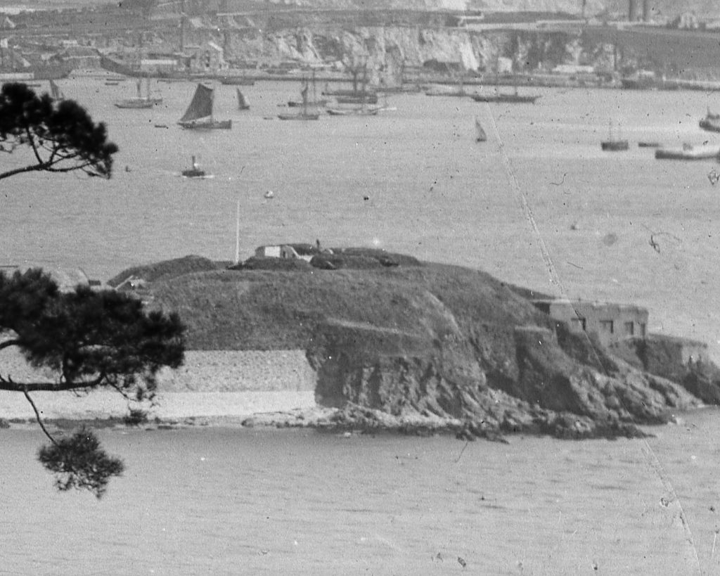
The two German reconnaissance photos from 1938 show the searchlight position below the casemates and the command posts on top of the Island. By this time trees had been planted on the side of the Island facing Plymouth, some can be seen in photos from World War I, but none on the opposite side facing Cornwall. Trees there would have impeded the guns arcs of fire.
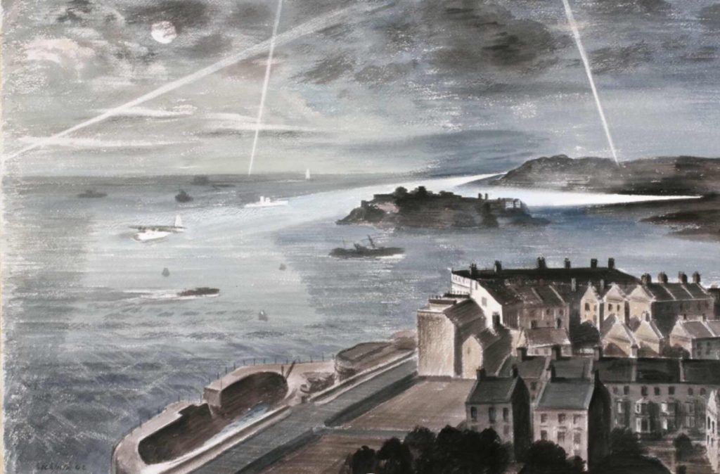
This is a painting done of a night exercise in the Sound in 1942. The Anti Aircraft searchlights and guns were 20 miles outside of Plymouth whereas the searchlights illuminating the Sound and guns defending against torpedo boats were much closer in.
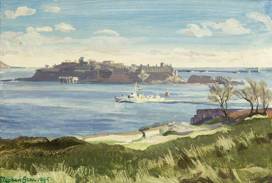
The painting from dated 1945 shows the Command Posts constructed on top of the Island prior to World War I still standing. They were all demolished by the Royal Engineers using the medium of plastic explosives before the Island was handed back to the Duchy of Cornwall in 1961. The jetty is also shown as complete to the front of the Island.
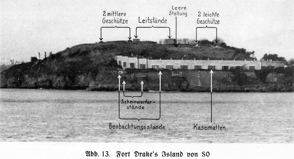
Taken from an open day programme run by the Royal Artillery in 1946 the command posts and protective screens are on top of the Island behind and above the casemates
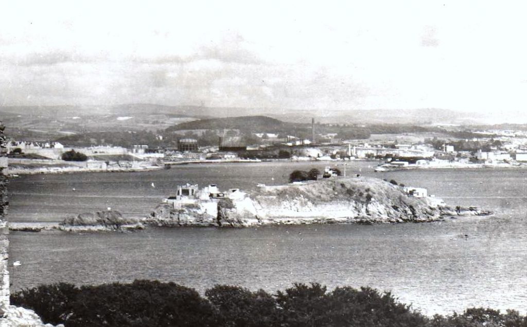
This image dates to around 1960, the command post is still in place at the top of the Island and no trees have been planted at the back of the Island.
From around 1970, the old RML guns have been discovered, the breech loading batteries can been seen running along the back of the Island before dog legging towards the centre of the Island.
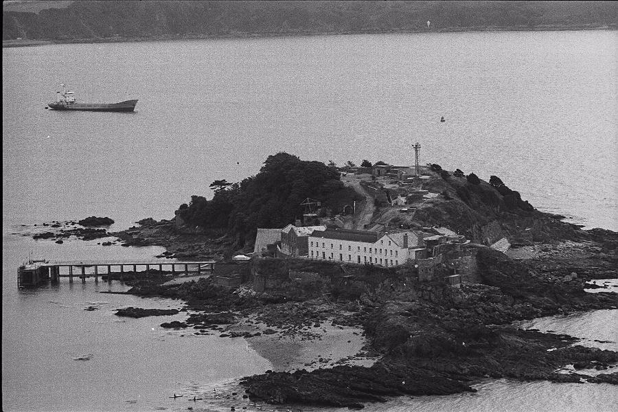
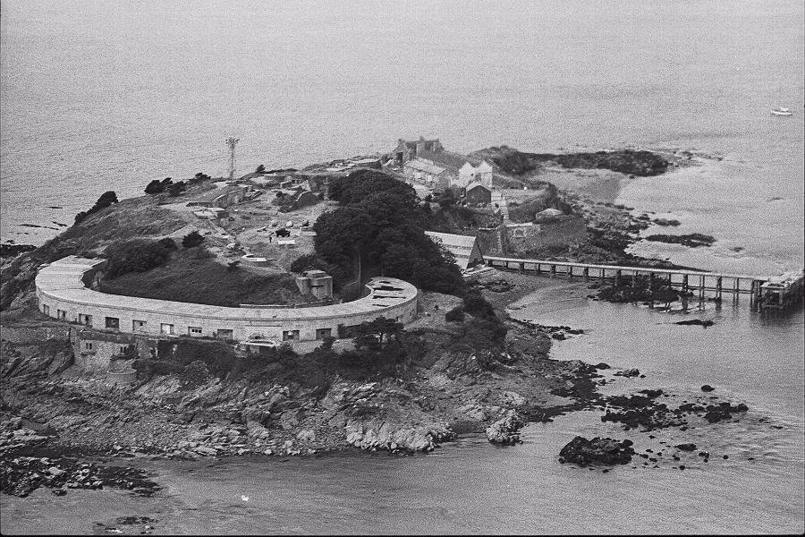
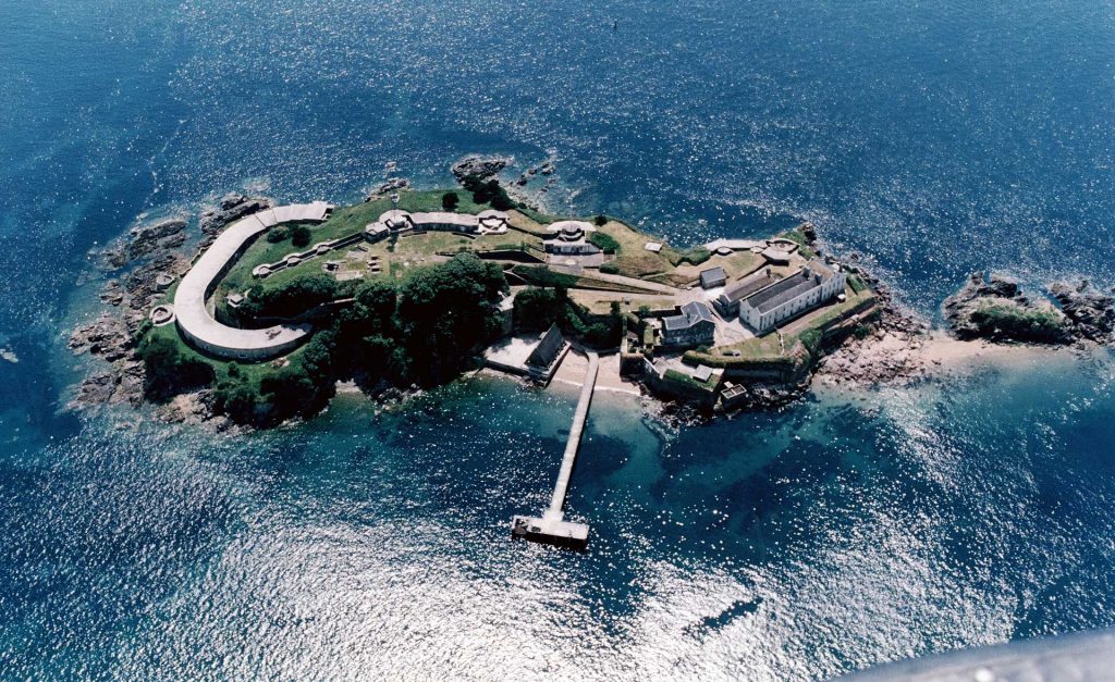
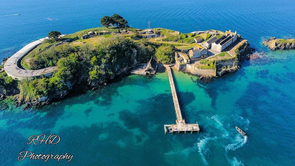
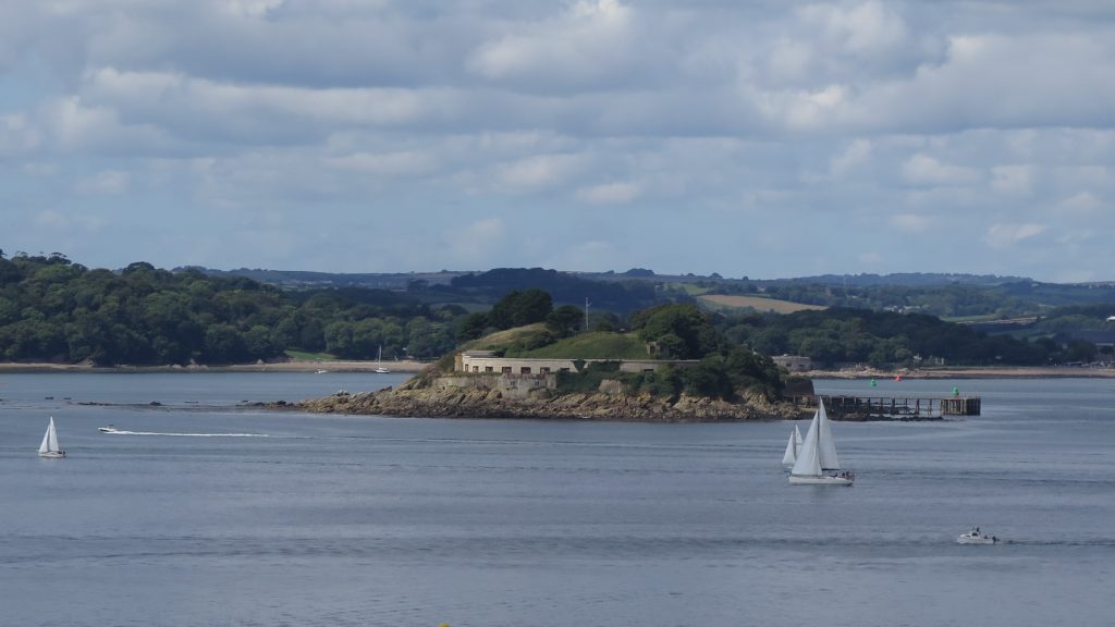
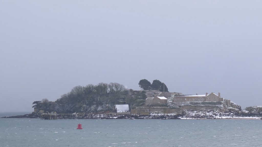
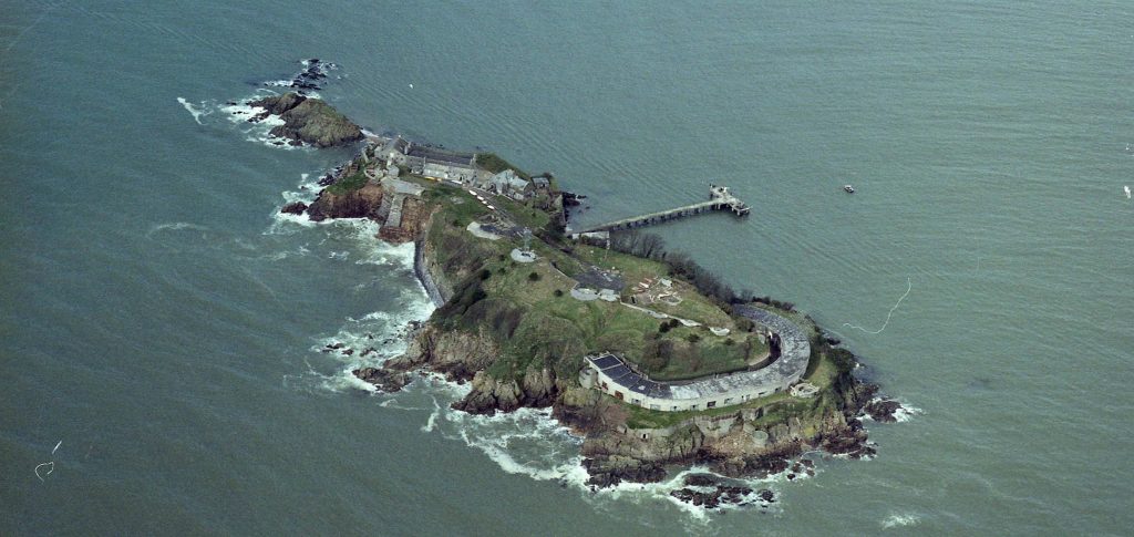
The two above are from around 1980, the 25 ton RML Gun is now mounted at the top of the Island and the Naval Navigation Mast is on top of the Island. It was removed around 2012. The final photos are a couple of overflight photos, the first prior to the collapse of the boat house in 2014 followed by one taken this year and lastly a few photos of the Island taken in the last two years from a couple of different perspectives